This post is the result of a student project. The work was done by the following group of students: Alice Rey, Jihene Haj Hamouda, Yahia Heni, Mohammed El Mehdi Alaoui, Kaies Mhadhbi.
Ever wished your walking route avoided the sun on a hot day?
You probably know GraphHopper, an open-source routing engine optimized for fast and accurate pathfinding on OpenStreetMap data. We have built on top of it to develop a tool that prioritizes shaded paths, enhancing pedestrian comfort. Using environmental data like trees and buildings, our system finds routes that stay cooler, even if they are slightly longer.
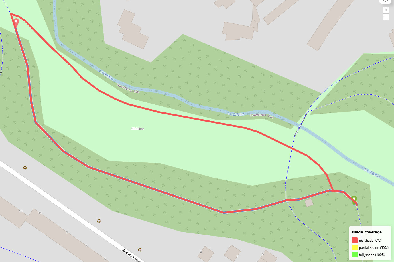
Three different routes produced by three different methods: GraphHopper’s default pedestrian routing (yellow), pedestrian routing using our observation-based method (blue), and pedestrian routing using our calculation-based method (red).
To incorporate shade into route computations, we developed two complementary methods:
An observational method involving onsite surveys and image analysis, to estimate and record the actual shade coverage on pedestrian pathways.
A computational method leveraging environmental data (building heights, tree locations) and sun positioning algorithms to automatically compute shade across entire road networks.
To learn more about how we use OpenStreetMap and custom algorithms to make walking more comfortable, read our full post here.
This is fantastic! It’s precisely the kind of usage I have in mind when I add information about trees, tree rows, or whether a street is tree-laden. (I never thought about the utility of the building levels quest in StreetComplete for this case, and from now on I’ll definitely see that in a… new light. )
You should add a link to this project from the wiki page Shadows, alongside the other shade-related projects which nicely complement this one.
Mammi71
(One feature, Six mappers and still More ways to map it)
3
in your blog you wrote:
One enhancement we implemented is a script that automatically assigns 100% shade to ways located in parks, reflecting the generally higher tree cover.
I think assuming 100% shade in parks is too optimistic. Parks I know typically have a rather loose tree cover. This also confirms your test map, if I assume aerial photos as a base layer.
On the other hand, I would expect paths that run in forests to be favoured. The tree population there is usually denser and therefore much shadier.
The time of day has huge influence around here (lat 30-35 south) in how the shade is useful or not.
Also, I would like to propose the opposite use case, a non-shade-optimized (or sun-optimized) route, as is what you look for, e.g., in winter, specially in early morning, to walk along the sidewalks where the sun shines, as it is much more warm and comfortable than walk along the shadowed ones.