If anyone out there goes hiking and uses the Ordnance Survey App, please could you correct this. I have tried but not being computer savvy, can’t do it and don’t have time.
For some unknown reason the one and only path on the Island of Mull that hikes up to Ben More and which is clearly shown on Ordnance Survey cannot be ‘snapped to path’ on their App (as they use Open Street Map) which when used, throws the direction off in all sorts of directions, and refuses to follow the path. It is beyond annoying. I did go to Open Street Map and there was this confusing mad line - but how one could get the Ordnance Survey feature/path corrected, I have no idea. Anyway, not going to be here to respond or be trolled. Hope someone can sort this out.
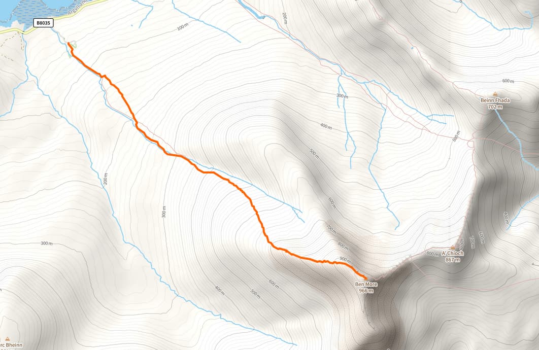
I’ve just had a look and the mapped path in OSM (e.g., [1]) looks to follow a very similar route to the aerial imagert and Strava’s Heatmap - so seems to be OK. What part is a confusing mad line?
I guess you’d need to contact the Ordinance Survey, it’s their app. OSM is not linked in any way to OS.
There seems to be some confusion. Ordnance Survey rely entirely on Open Street Map to plot a route on their App. It is not possible to plot the route on their App to hike up Ben More; the attempt makes the line go AWOL. So I wrote to Ordnance Survey and they sent me here - saying it was Open Street that made the error.
Where were you trying to start the route up Ben More? This screenshot highlights a path from the northwest, there are also approaches from other directions, but as @Casey_boy said, nothing stands out as unusual.
But you’re not using the OS App are you? You’re not able to put in your stride, the time, and it doesn’t give you how long the hike will take. I use OS for a reason and that reason is to be able to plot my route according to own timing to know how long it will take. This map - here is not a 1:25 map either, with details. So I’m not really sure what these comments are trying to prove. Perhaps you don’t understand my question. I was only interesting in getting Ordinance Survey App to work but OS customer services told me that if their mapping didn’t work it was due to this Open Street Map not using the correct settings. I can’t tell here because you’re not using an OS map.
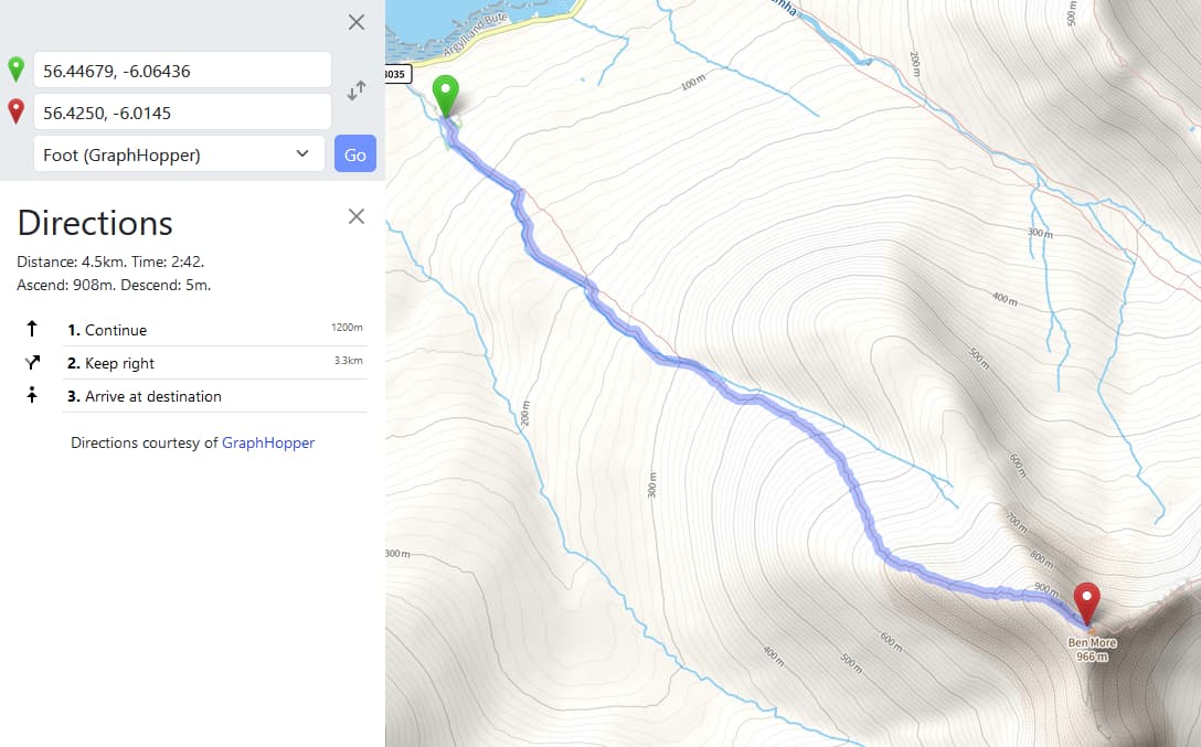
We are trying to identify where there might be a problem with OpenStreetMap data, which OS claims to be using. If we could see that OpenStreetMap data included some kind of crazy looping path, we could fix that in the data. The problem is, when we look at the raw data, there is no sign of anything like that. The screenshots are intended to illustrate that.
The only thing the volunteers on this forum could fix would be the data in the OpenStreetMap database. We don’t have access to the workings of the OS App. If we can’t find a data error, and OS can’t tell us specifically what the data error is, there is unlikely to be anything we can do.
Perhaps you could ask your OS contact to be more specific about the “error”. It would seem reasonable for their (presumably paid) staff to make a bit more effort before passing their technical support problems to unpaid volunteers.
Presumably if I did, I would get the same result as you, so I don’t think that would add anything.
Yes, unfortunately they do tend to say that. It isn’t always true**.
What IS true is that some data- which includes routable path data - is based on data from OpenStreetMap. However, what you see on the screen in the map may not be a good representation of that, and may include other data from other sources. You’re not the first person to complain that what they see on screen and the data used for routing are not 100% the same in the OS app.
I wouldn’t assume that staff on most commercial helpdesks are paid very much (or would even know which way up to hold a paper map). Their job is to get rid of callers as soon as possible, and foisting off support to a bunch of volunteers is par for the course.
As other people have said, you need to confirm that you are talking about this path. Posters above have said that it broadly matches where other people have walked up Ben More - can you explain in a bit more detail what seems to be wrong with it?
It would also be useful to know exactly what version of the Ordnance Survey app you’re using - different versions of that apparently show different (more if you pay more) data.
That’s true, but we can have a fair guess.We know that the routable data in e.g. this matches OSM. We know that the cartography is by MapBox, and at first glance is at best sub-optimal for the job in hand. We also know (from just using the app) that the alignment of “data from OSM” and “other OS data” isn’t always great (although to be fair it’s much better now than when first launched). We now what the OS do have data for (see e.g. here - “OS Detailed Path Network is a fully-connected, heighted path network covering Britain’s National Parks”) and can imply from that what they don’t.
** OSM’s Data Working Group (of which I’m a member) gets quite a lot of complaints along the lines of “XYZ third-party map uses OSM data and their helpdesk told me to call you”. In the vast majority of cases the reported error is with the third-party product not the OSM data. Ordnance Survey products are among that XYZ - they’re far from the most complained about, but we do get a few.
I’ve passed these comments onto OS. To be honest in the 8 years I’ve been plotting routes on their App I (a) never ran into any difficulties and (b) was never informed about open street map. I always assumed - as a subscriber to OS that I was getting their maps online and plotting a route from the App they managed which, until now, they never claimed otherwise. I think all your comments are fair points though. Thank you!!