Hello everyone, and I hope you can help me. I’m mapping some areas in my region and was wondering whether the tags natural=scrub and natural=scree are appropriate for the images you’ll find in this post.
In the case of “scrub”, I was unsure whether to map it as a forest, but it’s not really a true wooded area, since the trees aren’t very tall and are mixed with low vegetation. Also, there aren’t that many trees compared to actual forests.
As for “scree”, it should indeed refer to a scree slope, typically found on the sides of mountainous areas.
I look forward to your feedback and thank you in advance.
regarding your second example, I would map it as wood or forest if mapped as a whole, or if you were micromapping the lighter spots in the woods, scrub could be fine for these small areas.
Regarding your first example - to me, based on the orthophoto, it does not look like a scree at all. Scree is an area mostly covered by loose stones/rocks, see: Tag:natural=scree - OpenStreetMap Wiki
Yes, it usually covers mountain slopes, but it deos not mean that any sloped area will automatically be considered as scree.
What I do see in the image you posted, is rather an area of low vegetarion, I would say either natural=heath or natural=scrub, depending on what kind of vegetation it is (my gut feeling says it’s rather natural=heath). The steeper parts without vegetation along the road seem to be natural=bare_rock.
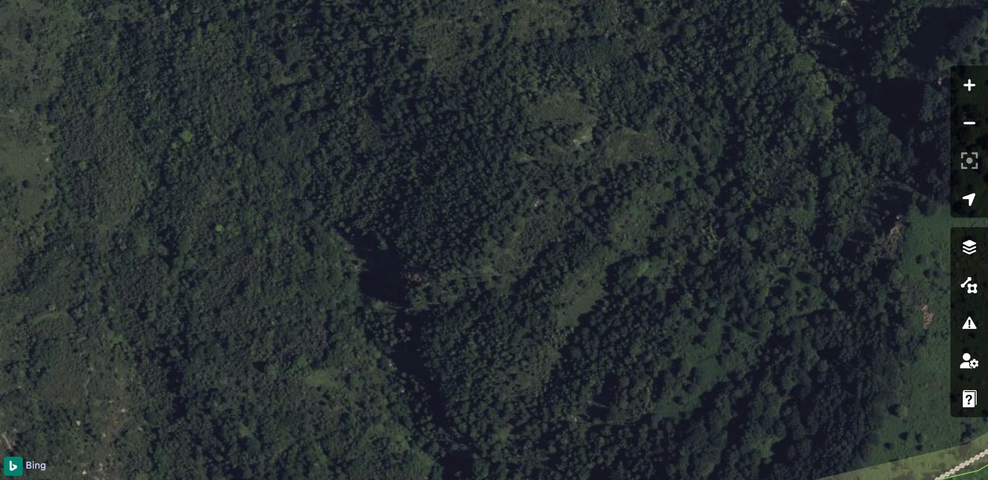
Thank you for your suggestion. Unfortunately, some types of terrain are difficult to map, as they feature a variety of different elements. How would you define the type of terrain in the image in this post instead? Of course, the question is open to anyone who would like to share their opinion.
Again, it mostly looks like natural=heath to me, with the darker parts of more dense vegetation being most probably natural=scrub. I have recently mapped a similar area in Spain if you would like to have a reference:
I understand, I saw the terrains you mapped but they seem very different from the one I sent you in the image. Of course, there are some similar parts, but the vegetation in my areas is very different. Thank you anyway for your suggestion, and I’ll try to figure out which type of terrain to consider for the mapping.
Thank you! After having examined the area, and specifically the parts mapped as natural=scree, I see mostly consolidated rock (natural=bare_rock) covered by low vegetation, being a mix of grassland, heath and scrub. For instance, here is an excellent example of bare_rock:
I really struggle to find areas with loose stones/rocks that could be clearly considered as scree.
Please note that the tag natural=scree is meant to indicate landcover rather than land form, not every slope has to be scree.
Thank you for your suggestion. Indeed, many parts look more like rock than gravel, so I’ll try to replace them with the appropriate type of terrain. I’ll keep natural=scree for those located on steep slopes.
Thank you, that’s actually something I usually do, especially where there are scree slopes, using the topographic map or personal knowledge of the area.
Can natural=cliff also be used for areas covered by forest? I’m asking because, as I mentioned, I usually use this tag only where there are rocky or scree-covered slopes.
Yes, why not. I have seen, and mapped, lots of cliffs in areas covered by forest. Here you’ve got a couple of examples (including screes as well):
Please note that these cliffs were mapped based the DTM available for editors in Norway (Kartverket DTM Digital Terrain Model), thus you won’t be able to see much of them by only looking at the orthophoto.
For low vegetation, you can use natural=grassland or landcover=grass depending on the context. If it’s sparse vegetation, natural=scrub may be more accurate. For scree slopes, the correct tag is usually natural=scree. You can also add surface=gravel if needed for more detail. Always check local mapping guidelines or the OSM wiki for best practices.