Often hiking trails are in a “lightly regulated environment”, to borrow a phrase from @Minh_Nguyen a couple of posts after yours. Signposting for hiking trails often has no legal force, it’s just a kind of suggestion, and means nothing more than some hiking-related organisation thought it made a nice route. So it usually doesn’t say anything positive or negative about other uses. A waymarked hiking trail may be also be both legally and practically perfectly suited to cycling or horse riding. Similarly a signposted cycling trail may be used as much by hikers as cyclists. I know lots of trails like these in nearby forests, and others that are more or less identical but have no signage at all. It would feel completely arbitrary to divide them between footways, cycleways, and bridleways.
The wiki is descriptive, not prescriptive. It should document actual usage which often differs from proposals, especially very old ones.
I’m not sure if you are aware of the recent very extensive discussions about highway=path here on the forum, but these points have come up and have been answered multiple times and I’d rather not re-hash the entire discussion here.
TLDR:
It’s ridiculous and actively endangering people and causing rescue operations that these two kinds of ways are using the same tag in OSM.
highway=footway/cycleway/bridleway/path are about more than just legal access and have implications about the quality of the path and the practicality of using it. Sub-tags can mitigate some of this but are inadequate for solving this issue.
As a sidenote, I’m curious why people keep insisting that footway/cycleway is only about legal access when that is completely untrue for other highway=* tags.
Because that’s what the accepted proposal was about: creating a generic non-vehicle highway that can be anything you tag it: A footway, a bridleway, a cycle way, a shared use path, or a hiking trail.
I’m curious why people interpret things into a path that aren’t mentioned on the wiki. Is it the name “path” that makes people associate it with something? I’m really curious, because if people were properly using access, surface, and width, you wouldn’t be having this discussion.
Yes, there is a difference between a highway=path and a highway=footway other than access-tagging, but it certainly is not the quality of the path. But I’m sure there are areas in the world, where people think “it’s rural, it must be path”, or “it’s in the forest, it must be a path”, or even “surface ground means path!!!” ![]()
As a reminder: This topic is about documenting the actual usage and interpretation of highway=path vs. highway=footway practiced by many local communities. What a proposal once said as an alternative tagging that didn’t really catch on does not really matter much here and blaming people that ‘they should just set XYZ other subtags’ is also irrelevant.
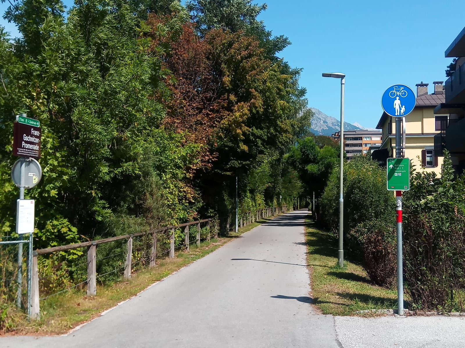
This might partly be because the main picture for footway in the Wiki is paved and urban and has a formal looking sign. The main picture for path is unpaved, is in a forest and doesn’t have any signs.
I guess over the years this could have impacted how people think of the two tags, and how people have used them?
I’m not blaming anyone. It’s just a fact that any highway that is not made for vehicles desperately needs a surface-tag, and better yet a width, before you can assume anything about the practicality of using it for a certain purpose.
Whether the originally intended usage has caught on or not, lies in the eyes of the beholder. Or should I say: it greatly depends on where you look. So i f you want to document the actual usage of highway=path, adding exactly that the standard of what highway=path means varies greatly between the different mapping communities, countries and regions.
If this is the main reason, then by all means, let’s replace the picture with a mosaic of pictures of what a path can look like, so it gets to people that the tag becomes only really meaningful with other tags ![]()
You mean the proposal for highway=path? But that couldn’t change the meaning of the existing footway tag.
I’m not sure, that back in 2008, the meaning of highway=footway was more than “here be pedestrians”, but who knows.
As for changing the meaning:
[…]
highway=path+foot=designatedis supposed to be equivalent tohighway=footway.
is what the proposal says, and why it optionally also wanted to deprecate footway, cycleway, and bridleway (which didn’t get accepted). The proposal didn’t need to change the meaning of highway=footway in order to achieve equality ![]() So in countries where
So in countries where highway=footway implies anything about the surface of the footway, highway=path + foot=designated should automatically do the same. Or am I misunderstanding your reply?
That’s what this is all about in the first place, isn’t it? I’m aware that highway=path is extensively used in Germany for shared ways, but that is far from universal and lots of other communities handle this differently. That’s why this should be documented.
Adding a picture like that to the highway=path page has in fact been done as a result of these recent discussions about highway=path.
If people were actually reading and scrolling down the page before, they would have seen that the meaning of highway=path is plenty fold. What I meant was replacing the very first picture in the ValueDescription-box with something like a 3x3 mosaic of different types of paths, so the first thing they see isn’t a path in the forest, but 9 different things of what a path could be.
But adding the other pictures down below is already a welcomed addition that I want to applaud you all for.
I’m honestly not sure, I see that combination very rarely, most paths I see have no defined access so no designation tag. But realistically most mappers follow editor presets and what they see other mappers have done in their local area, rather than trying to understand the relationship between concepts in wiki pages that have developed separately over 15 years.
None of this changes the fact that a lot of communities prefer using highway=footway/highway=cycleway over highway=path for ‘higher quality, urban style’ ways and use the latter for ‘rural style’ ways or hiking trails. The picture in the wiki exists to document the fact that the use of this tag is inconsistent, not that it should be used like that everywhere.
Last time I checked: bicycle, mofa, snow-mobile, horse all vehicles? Maybe horse controversial. Emergency vehicles as much? Highway=path definitely not about not-usable-by-vehicles, not even designated-for-non-vehicles. As a reminder: mapping intent is not trivial. But that is what designation is about.
I did start that in one of the other topics linked above. But found, that the only picture that was acceptable to all the parties involved looked much the same as the current header picture. Actually, I experienced that kind of a relieve. So no, the picture not in need of change.
Maybe a table with what considered path across the globe? And pictures please!
Apologies for raising this again, but there’s one major way in which it is not equivalent - there’s no place for an access tag. In places where there isn’t a “right to roam”, foot access might be yes, or permissive, or customers or a number of others. With highway=path; foot=designated there is simply no way to record that.
As a data consumer in one of those countries what should I treat the foot access as on a highway=path; foot=designated? Is it yes (like here), permissive (like here) or something else (like probably here)?
highway=path is also part of the preset for golf cart paths.
(It’s a long story. It was highway=service for a while, but that annoyed a lot of people and possibly directly caused real-world accidents. The highway=golf_cart_path proposal never made it to a vote, so editors didn’t adopt it, so golf mappers didn’t use it. As a stopgap measure, the preset was updated to use highway=path golf_cart=yes, which at least didn’t cause delivery vans to run golfers off the road path or get stuck in little tunnels. It couldn’t follow the highway=path proposal completely, because golf_cart=designated would’ve been inaccurate at a private golf course, of which there are many. Have I mentioned my dislike of the highway=path proposal? ![]() )
)
Whatever the wiki says in fine print, I find it hard not to draw a parallel between highway=path and the other catch-all value, highway=road. The difference is that we generally tell mappers they must clarify the tags further if at all possible, by choosing a different highway=* value besides road, whereas with highway=path that seems to be a difficult proposition.
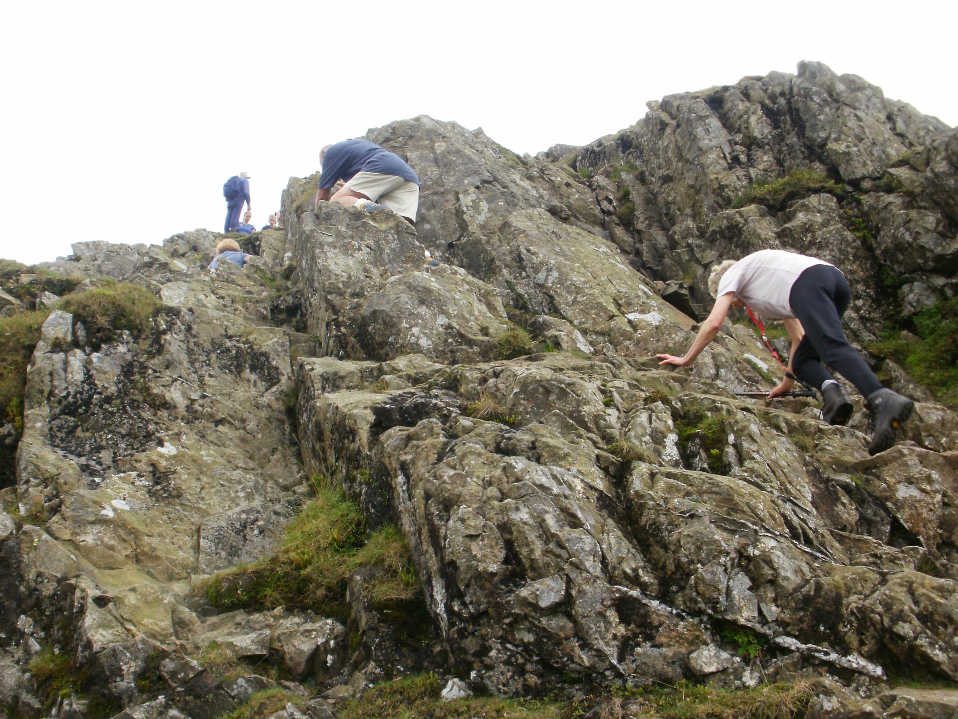
I am a bit uncertain, whether to dispute usage of highway=path for pathless mountaineering routes or whether to dispute usage of highway=path for 3m wide paved promenades very well passable by hgv, if need be.
I just guess, neither will find enough approval for a formal proposal.
The current wiki article on highway=path to me reads like a single big “NO”, dot not use that.
It is de-facto the (mostly) non-vehicular highway=road. The main problem is that we do not really have any more specific alternatives besides highway=footway/cycleway/bridleway.
Why not both?
I think a big reason why the proposal for highway=scramble did not succeed was because it wasn’t very well fleshed out and was very lacking in documenting the rationale why it is needed in the first place and why highway=path with sub-tags is not a suitable alternative.
Yes, let’s create them. There is no reason why paths should be limited to just a few primary feature tags. There are 21 different highway= values for roads.
Thank you. I oppose: This was very well fleshed out, but the sheer number of concerns might require even more fleshing out. I found that an insightful post, but I doubt, the results will be different:
Not everything needs to be a separate value, but we could certainly use some more detailed options in this department.
It’s a bit ironic because highway=primary/secondary/tertiary/... often have relatively few differences between them compared to the things discussed here that they might as well be a sub-tag instead of different main values.
I specifically mean the reasons against using highway=path + sub-tags, which were the main source of opposition against the proposal.