Als ik in de webontwikkelaars hulpmiddel kijk.
Firefox Ctrl-Shift-I tab network.
Wil hij het volgende ophalen.

Hij vraagt aan
https://service.pdok.nl/fietsplatform/regionale-fietsnetwerken/wms/v1_0?LAYERS=fietsnetwerken&TRANSPARENT=TRUE&FORMAT=image/png&SERVICE=WMS&VERSION=1.1.1&REQUEST=GetMap&STYLES=&SRS=EPSG:900913&BBOX=610884.72997009,6816959.9296362,611496.22619629,6817571.4258624&WIDTH=256&HEIGHT=256
daar staat
&SRS=EPSG:900913
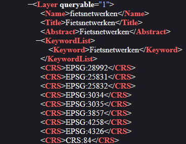
terwijl hier de projecties staan, dus geen 900913
je kan een projectieparameter toevoegen.
CRS: "EPSG:4326",
{layers: "fietsnetwerken",
	CRS: "EPSG:4326",
	transparent: true,
	format: "image/png"
}
Die googlemaps projection opvraag komt uit je html file
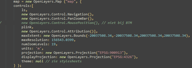
lukt het dan wel?