In the interest of time, I’m only going to respond to some of your points in full detail. Unfortunately, I don’t think I’m going to convince you about the road–route distinction, but this topic is really for everyone else too.
It’s one thing if the correct road number is verifiable on the ground, or if people refer to the road by the number anyways, just as they apparently know the names despite the lack of signage. But I don’t think ref should be a dumping ground for internal inventory numbers that one can only discover by consulting the operator’s database and that one cannot practically use in day-to-day activities. There are plenty of numbering systems that we choose not to map. I don’t think this is a controversial stance in OSM.
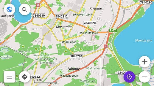
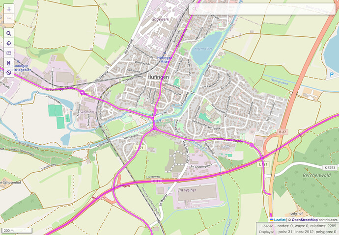
Every region has its own quirks, but as a project, we do generally try to avoid leaving gotchas for data consumers. If nothing else, it saves the community the trouble of having to get all the data consumers on the same page about some obscure exception, like these local route numbers in Organic Maps and OsmAnd that probably shouldn’t be rendered:
Nevertheless, if the local community in Estonia thinks this kind of mapping is useful, that’s an argument against coopting ref on route relations, which have always been primarily about rendering route shields on maps, mentioning route numbers in navigation instructions, and other practical uses.
Of the 15,255 route=road relations in Germany, only 6,562 are tagged with network. Of the remaining 8,693 relations, 6,978 (or 80%) are Landesstraßen, which is a signposted road classification. As far as I can tell, none of them has mismatching member way names. This suggests that the relations represent roads rather than routes, or to put it another way, routes that as a rule consist of only one road. Overall, route=road relations account for just 11% of the 2.1 million kilometers of navigable roads in Germany (including concurrencies).
Given the occasional angst that German mappers express in global forums regarding relations for long-distance routes, or regarding bus routes, I suspect there’s very little appetite for systematic street relation mapping there.
This discussion stemmed from the retagging of 28 relations in Fremantle, which were created for the purpose of consolidating wikidata tags so that they would automatically appear in the now-broken infoboxes of the English Wikipedia’s articles about Fremantle’s streets. Both of us were being kind of nosy by jumping into the fray, but @Sam_Wilson’s toot caught my attention and the rest is history.
It was never my intention to make this a global policy decision about whether streets elsewhere should be systematically modeled as relations; otherwise I would’ve started this topic in a global category. However, it seemed reasonable to consider the precedent that this decision might set in other places that have similar road and route networks. The subsequent back-and-forth about roads versus routes has highlighted a stark difference in perspectives across continents, but I hope I’ve demonstrated to everyone else that, here at least, “route” is not just a stylistic word for “road”.
I am a mapper first and foremost. I only referred to OSM Americana as an example of a data consumer that uses route relations. This project sprang from the U.S. mapping community and is inseparable from it. We didn’t invent route=road relations – the honors belong to the German community – nor was Americana the first renderer to make use of them. Far from dictating how the Australian community should map, we have been supporting their decisions, turning their recently overhauled road tagging guidelines into a map that they can use to track their retagging progress and share the results with friends and family.

