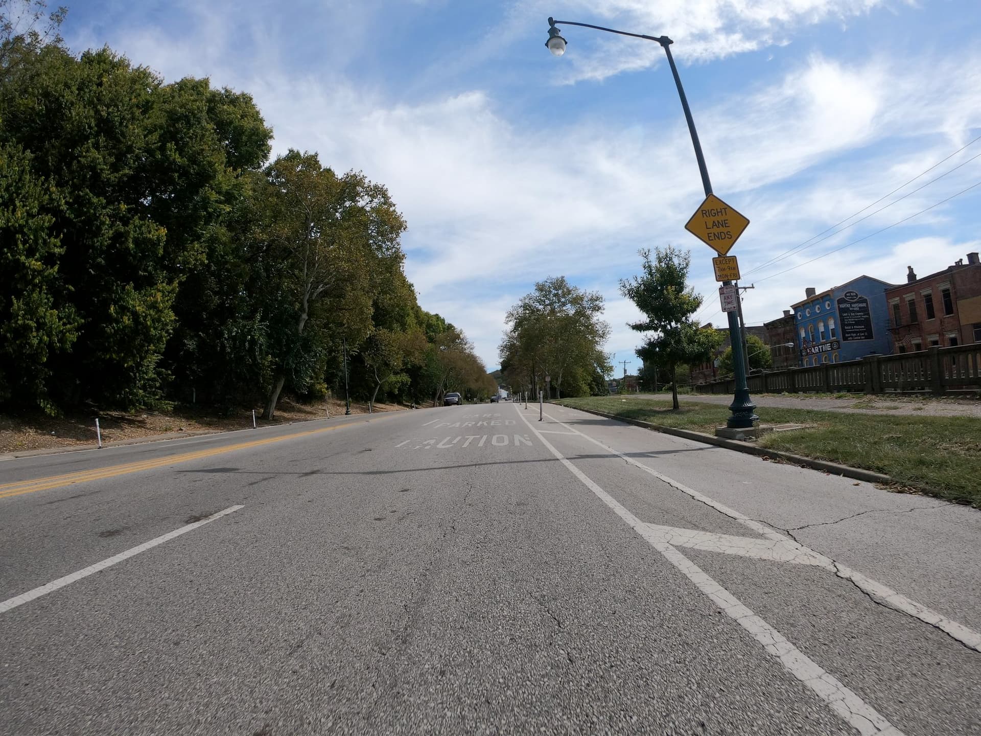
By the way, the older dual-use lanes in this city begin quite abruptly; I’ve nearly collided into a parked car after coming around a curve. On a more recent conversion of Central Parkway to a dual-use lane, the city put up warning signs and markings ahead of the parking spaces that make it pretty clear that the right lane isn’t a travel lane during parking hours:
Central Parkway frequently alternates between a dedicated parking lane and a dual use lane. The conversion initially caused a lot of confusion despite the temporary signs they put up to educate the public:
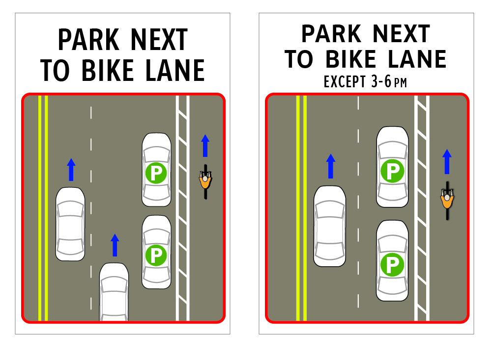
They’ve since replaced the signs with simpler diagrammatic signs. These signs have legal effect because they follow basic principles of regulatory signs, but they aren’t standard in the sense of being codified anywhere.
Along space-constrained blocks, the standard lane divider markings continue uninterrupted, but driving is prohibited during parking hours, even if the spaces are unoccupied:
I’d tag this as:
lanes=1
lanes:conditional=2 @ (Mo-Fr 07:00-09:00)
placement=right_of:1
parking:right=lane
parking:right:restriction:conditional=no_stopping @ (Mo-Fr 07:00-09:00)
parking:right:markings=no
cycleway:right=lane
But if driving were always allowed in the absence of parked cars, as in the original post, then it would be slightly simpler:
lanes=2
placement=right_of:1
parking:right=shared_lane
parking:right:restriction:conditional=no_stopping @ (Mo-Fr 07:00-09:00)
parking:right:markings=no
cycleway:right=lane
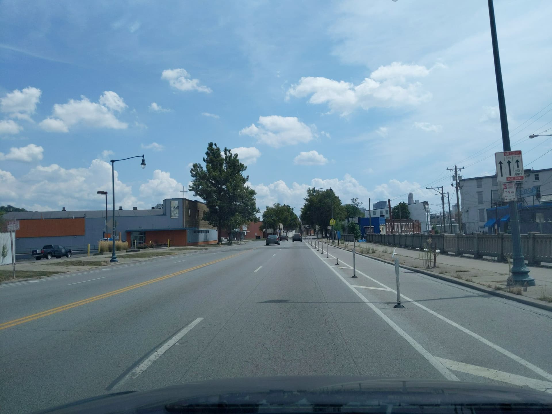
Along more spacious blocks, there’s a dedicated parking lane, but it’s mostly unmarked:

I’d tag this as:
lanes=3
turn:lanes=left|none|none
change:lanes=no|not_left|yes
placement=right_of:2
parking:right=lane
parking:right:fee=yes
parking:right:markings=no
cycleway:right=lane
It would be nice to indicate the relative positions of the parking and bike lanes somehow. If we do so using the *:lanes=* syntax, then these tags all get more complicated:
lanes=3
vehicle:lanes=yes|yes|yes|yes|no
bicycle:lanes=yes|no|no|no|designated
turn:lanes=left|none|none|none|through
change:lanes=no|not_left|yes|not_right|no
lane_markings:lanes=yes|yes|not_right|not_left|yes
placement=right_of:2
parking:right=lane
parking:right:fee=yes
parking:right:markings=no
cycleway:right=lane
Parking-protected bike lanes are becoming more common in the U.S., just like in Germany, so maybe some complexity is unavoidable. But I’d echo the sentiment that requiring this level of detail anywhere there’s dedicated parking would probably raise the barrier too high for most mappers to consider mapping street parking. I hope we can find a solution for the German dual-use lanes that results in reasonably simple baseline tagging for everyone.