There are several issues here:
- Krummholz (e.g., above Lü, possibly mapped as scrub) which is usually recognised as wood/forest e.g., by WSL. This is characterised by apparently widely spaced trees, although often there are very small woody plants between these trees. There is also a recognisable ecotone between this and the alpine pastures above. The area round Grüensee, Zermatt is also pretty much of this type, and the SwissTopo schematically shows trees rather than wood symbology.
- Wood Pastures. As mentioned by @biobuur. These have been discussed extensively in the past (e.g., in the context of Portugal and Dehesa in Spain, but they exist in one form or another across Europe). Although wood pasture is definitely the term of art in English a whole range of tags have been suggested including various aspects of pasture, sylviculture & so forth.
- Woods which just have trees fairly widely spaced. The Larch-Arolla Stone Pine woods, such as God Tamangur, up above S-charl are very good examples.
- Other areas containing scattered trees. Parkland is an archetypal example in the UK, but similar situations exist in other areas. For instance both in the area destroyed by the 1806 Bergsturz, and area to the West the forest has not restored itself so the canopy is closed. Again SwissTopo shows individual green dots and not the solid green of wood/forest.
My basic suggestions would be:
- For things which are ecologically woods, keep wood/forest tagging. Do not introduce a new tag which is likely to be inherently subjective.
- For wood pasture landuse=wood_pasture
- For things which aren’t ecologically woods, e.g. parkland with extensive trees, use a tag like scattered_trees=yes. This could be applied alongside to many different landuse, natural or as here, leisure tags. This would help with the issue @yvecai raises.
I would additionally suggest finding a way to tag the following:
- Whether the woodland canopy is closed or open. If you walk through can you see the sky from nearly everywhere. Old growth pine forests in Scotland are nearly always open canopy.
- The actual density of trees on some simple scale. This can be estimated from both aerial imagery and by forester’s techniques on the ground. I have actually done this for a random selection of 100 Dehesa plots in Extremadura, Spain, sampling across CORINE land parcels. Obviously it is easier for wood pasture as the trees are always widely spaced. In many parts of Europe this data is collected as part of national forest inventories, but it may not be either readily available or open data.
Ecotones are potentially mappable, but that’s another topic.
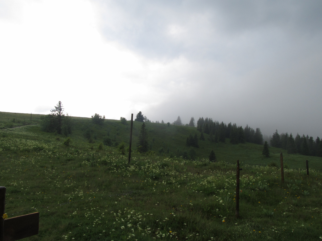
Lastly, a picture of the scattered trees on the Feldberg where snow, wind etc. stops most from establishing themselves. Yes, it was wet.
I’m sure I’ve forgotten a few other points, from earlier studies I have made in this area.