This is a common layout of an intersection. If you want to map it in more detail, I would exactly do what you suggest:
I would add two short new (, vertical diagonal) ways, one from the “sidewalk” highway=cycleway to the main highway and “after” the intersection one from the main highway to the “sidewalk” highway=cycleway with following tags:
highway=cycleway
bicycle=designated
foot=no (or maybe access=no)
oneway=yes
cycleway=link
placement=transition
- Access tags might depend on the country
cycleway=linkgives the detail that the way’s primary purpose is a link for routingplacement=transitionis the tag to say that the way’s placement is not in the middle of the road/way but somehow diagonal and that angles on both sides are off or virtual. It’s a pity, thought, but many router software do not useplacement=*atm.
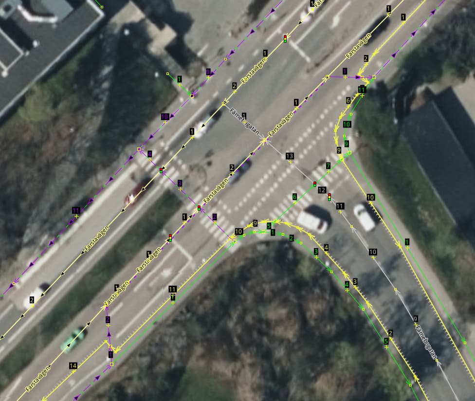
Then we need to adjust the surrounding ways:
- The sidewalks around the intersections need to be downgraded to
highway=footway,footway=sidewalk - The main highway needs cycleway tags as proposed. Mainly
cycleway=lanethough there are more tags for further details.- If the main highways are tagged in detail with
*:lanestags these tags’ values need to be adjusted andcycleway:lanes[:forward/backward]=*andbicycle:lanes[:forward/backward]=*need to be added. (Forward resp. backward depend on the way’s direction)
- If the main highways are tagged in detail with

In general, I miss some tags for more details about the separately mapped sidewalks/cycleways:
- On the main highway, I would add a
cycleway=separateresp.sidewalk=separate - On the separately mapped cycleway/sidewalk, I would add a
cycleway=sidewalkresp.footway=sidewalk.
Hope this helps. Feel free to ask further questions for deeper details as comment.